2025-2026 Status: MET IS CLOSED TO THROUGH TRAFFIC. Although the gate at 88 may still be open, there is significant snow accumulation and it is not passable.
Join the NorCal 4x4 Rescue MET facebook group here to discuss MET conditions and meetups!
What is MET?
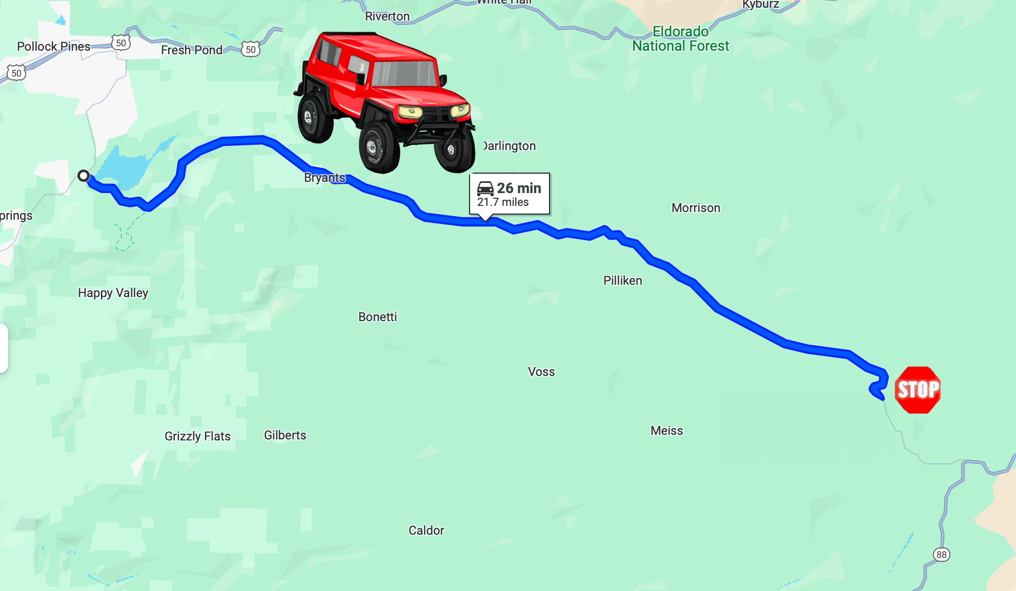
MET stands for Mormon Emigrant Trail (also known to locals as Iron Mountain Road), a forest road that goes from Sly Park Rd in Pollock Pines to Highway 88 and is 29 miles long. It starts approximately 60 miles east of Sacramento, CA.
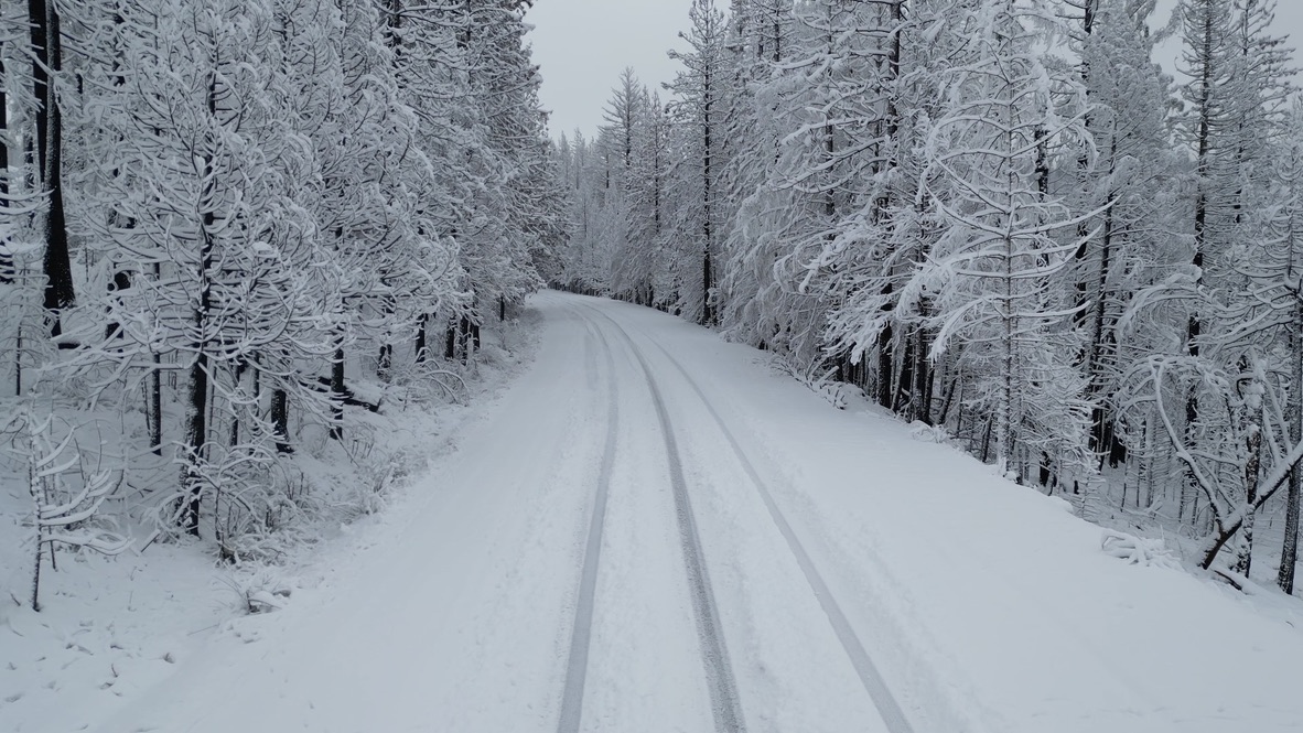
During the winter, MET is closed to through traffic - but a large portion of it is OPEN to OHVs and 4 wheel drive highway legal vehicles. Many 4x4 groups have meets where they go “snow wheeling” on MET all winter long. It slowly increases in elevation (and snow level) allowing people to easily only go as far as they are comfortable with.
The 4x4 portion is 21.7 miles long and goes from the west entrance @ Sly Park Rd (38.7199359,-120.574369, elevation 3526) to 9N20 (38.64098, -120.24861, elevation 7400ft), which is just beyond Silver Fork Rd. Beyond 9N20, only tracked vehicles (snowmobiles) and OHVs are allowed. It is NOT accessible from Highway 88 during the winter as there is a closed gate. We recommend you turn around at Silver Fork Road, where there is typically a safe open space to do so. Do not go around closed gates.
For the latest information, check out El Dorado National Forest’s facebook page:
https://www.facebook.com/pg/eldoradonf/posts/
Getting There
From US50, take the Sly Park Rd exit (exit 60) and turn south. Travel 4.7 miles and it is on your left, just past the lake.
Preparation
Always prepare as if you will get stuck and will have to spend the night. Much of the road has little or no cell coverage. When possible, do not travel alone. Your vehicle should be 4x4, have A/T or M/T tires, good ground clearance, and recovery equipment. You should carry food, water, extra fuel, warm clothing (boots/hats/gloves) and blankets - at high elevation the overnight temperatures can be extreme. A SPOT or inReach is recommended to get help when there is no cell coverage.
If you have your ham radio license, have the High Sierra Repeater programmed as it has good coverage throughout MET and El Dorado County. 146.805 -.600, PL123.0
Make sure you are a member of the NorCal 4x4 Rescue and El Dorado Urban Recovery facebook groups. They are full of many members that assist in recoveries if you get stuck!
Pack it out - and pick up trash! Please respect our National Forest lands. Bring a trash bag for yourself AND other trash you may find along the road.
Snow driving tips
If you are a novice, the most important thing you can do is air down your tires. 15-20PSI is typically a good target pressure.
Spinning your wheels will probably result in getting more stuck! Once you are buried down to your frame, rescue becomes considerably more difficult.
Go slow and keep a safe distance! Pass other vehicles with extreme caution. There have been many instances of vehicles sliding into one another.
Don’t be a burden to others. If you get stuck and others are there to assist, accept their assistance and return to a lower elevation. Do not get yourself stuck a second time.
Do not be the person that blocks the only through path for other more capable trucks or drivers.
Stay on the main road. Dirt roads throughout the El Dorado National Forest are closed in the winter to prevent erosion. If you are caught off the main road, you will be cited.
About The Area
Pollock Pines is a CDP (census designated place - not a city) that heavily relies on traffic and tourist dollars. Please buy your supplies here & patronize local businesses! Off the Sly Park exit, you will find Safeway & CVS, True Value, Shell, O’Reilly & NAPA, Pizza Factory, 50 Grand Restaurant, and more!
Want To Spend The Weekend?
Check out the MotoRetreat Airbnb - less than 1 mile from Safeway & 5 miles from MET. Sleeps up to 6 (with 6 individual beds!!) and has plenty of parking for all of your 4x4s… and even an air compressor to air back up after your trail run!
Weather forecast for MET@Silver Fork Rd, 7000’
MET Elevation Chart
Q&A
Q: “Could a stock gx460 do this if I went with proper tires and friends?”
A: Absolutely… it’s just a snow covered road where the snow gets progressively deeper. You just go in as far as you can then turn around…….Or spend all day learning better snow driving control! With friends is good because you can have a little more fun if you know someone can pull you out when necessary :). t’s also most fun after a fresh snow… CalTrans often has graphs showing snowfall at various elevations along US50, this is a good site to watch: Caltrans District 3